
San Francisco has now recorded below-normal high temperatures 12 days in a row. That streak is unlikely to be snapped anytime soon as the Bay Area’s cool June continues.
Monday’s temperatures are forecast to reach only the upper 50s at the coast, 60s along the bay shoreline, and 70s to mid-80s inland. A tight pressure gradient will promote strong breezy northwest winds, especially along the Peninsula. Gusts up to 40 mph are possible at San Francisco International Airport and may exceed 30 mph near the Golden Gate Bridge.
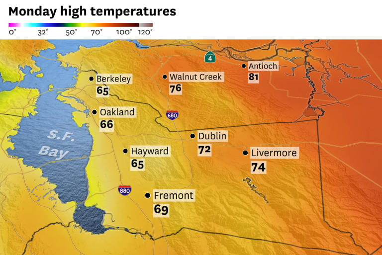
San Francisco is expected to remain in the upper 50s to low 60s Monday, with frequent gusts of 25 mph or stronger throughout the afternoon and evening. The marine winds will extend to the East Bay valleys. Livermore may not reach 75 degrees, which would be about 10 degrees below its daily average temperature. Santa Rosa, Fairfield, Vacaville and Antioch have the best chances of eclipsing 80 degrees.
The strong winds will probably mix out the coastal fog for partly sunny skies by the late afternoon, even in San Francisco. Fog will try to re-form overnight but should burn off quickly again Tuesday.
Temperatures will warm slightly Tuesday as winds relax. Wednesday looks like the warmest day of the week: San Francisco will still remain in the 60s, but the inland valleys of the Bay Area should warm to the 80s to low 90s. Parts of the Central Valley will hit triple digits Wednesday.
Cooler weather will return Thursday and continue through the weekend. No heat waves are likely across Northern California anytime soon, with weather models advertising a potentially cool and windy period across the state in time for the weekend.
